Thursday, May 31, 2012

#17 - Ketchikan to Meyers Chuck

After purchasing 7-day licenses for the fishing crew and last minute provisioning, we left busy Ketchikan City Float a bit after noontime for points north.  The town is bustling with three cruise ships in port and navigating between ships, boats and seaplanes to "get out of town" is a chore.  Soon we cleared Tongrass Narrows into Clarence Strait losing the traffic and beginning to feel a hint of ocean swell.

Our Route from Ketchikan to Meyers Chuck

The ships were in and the City was busy.

Vince tries to stare down the Zuiderdam

Planes, ships and boats congested the City's waterfront.

We slowly made our way up the Cleaveland Peninsula and in no-time (about 3 hours) arrived at our destination.  Meyers Chuck is a small bay with a public dock and about 25 homes scattered around the shoreline.  Our late afternoon arrival assured us that the dock would be full so we anchored in the center of town.  A happy hour party began on the dock but the Wild Blue crew was too pooped to launch the dinghy.  Our sole contact with the good people of Meyers Chuck occurred the next morning when the local baker delivered hot cinnamon rolls to our door.   

The public dock was full so we anchored in the center of town.

About 25 bayfront homes line the shore of Meyers Chuck.

Wednesday, May 30, 2012

#16 - Back to Alaska

On Wednesday we recrossed the Dixon Entrance by jet and set down at Ketchikan Airport ready to resume our summer cruising.  We were accompanied by our friends from San Luis Obispo, the Fontes and the Frenches.  This group are Wild Blue veterans having experienced the best and worst that Mother nature can dish out while aboard, yet they keep coming back year after year. They'll crew with us from Ketchikan to Sitka with stops at Meyers Chuck, Prince of Wales, Kupreanof, Kuiu and Baranof Islands.

After crossing the airport "bridge to no where" via ferry boat, we arrived to find the boat in great shape and set about assembling the new fish table.  Even though we don't catch a bunch of fish, we want to look like we do, hence the table.

We'll get started to Sitka tomorrow after provisioning and dining in Ketchikan.

Pat's plants grew without an attending gardener.

The boat looks way more Alaskan with this fish table.

Where's the fish?

Marianne and Vince Fonte, Chuck and Carolyn French the Wild Blue crew to Sitka.

Saturday, May 12, 2012

#15 - Prince Rupert, Dundas Island, Foggy Bay or Ketchikan?

The weather is great inside Baker.  Who knows what's going on outside as radio communication is zilch inside here.  Today will be a repeat what has worked out so far: continue as far as the weather lets us, knowing there's a storm out there somewhere.

We waited for 8AM slack then exited Watts Narrows hoping for Prince Rupert with calm seas.  As we cleared Malacca Passage entering the southern edge of Chatham Sound we expected ocean swells or at least big chop from the Skeena River delta outflow, but there was only flattish water. Instead of Prince Rupert's main Kaien Island south entrance, we changed course for the western end of the Venn Passage entrance, near to the same course as to Dundas Island..  Our idea was to continue on to Dundas Island if weather held, but we could always bail out and take the protected Venn Passage into Prince Rupert.

Almost two hours later at the sea buoy marking the start of Venn Passage, Chatham Sound remained relatively calm making for a comfortable ride.  So it was onward to Dundas.  Every year as we plan our crossing of Dixon Entrance to Alaska, Brundige Inlet on Dundas is the fail safe bailout spot just prior to beginning the transit. We've always wanted to spend an evening here but the weather has cooperated so we always continued.  Maybe we'll get our wish today?

Aren't these BC lighthouses pretty! This is the Green Island light which sits near Dundas Island just below Dixon Entrance East and provides important weather info for those crossing the Entrance.

At 3PM off Dundas we radioed the Billie H, a tug with large tow about 5 miles ahead of us in the middle of Dixon Entrance.  He reported a 4-foot swell and variable 5-15 knot breeze.  He expected the swell to build somewhat.  With this info we committed to make Foggy Bay and bail out there if needed.  It's always better to cross these open water bodies when the going is good.  So we did.


Three hours later off Foggy Bay the swell was 8 feet and the wind was steady 15 with gusts to 25 knots.  This is normally not good, but both were coming from the stern.  The boat was rocking and rolling a bit much with stabilizers on maximum, and surfing up to 11 knots at times.

The Schooner Windjammer in Dixon Entrance later bailed out at Foggy Bay.

We saw the Schooner Windjammer  just behind us bail out at Foggy Bay, but we decided to just get it over-with, continuing on to Ketchikan for a 9PM arrival. We toughed it out and were happy to be in calm waters at Tongarss Narrows.  Somehow we were able to clear US Customs over the phone, a first for us.  As we approached the Ketchikan waterfront, out of the blue the Harbormaster called us on VHF saying they had a spot on City Float in the center of town.  They took our lines, welcomed us, and passed on that we were one of just two pleasure boats that crossed Dixon Entrance to Ketchikan this day. It's nice to be in any port in a storm.

At rest on City Float.

We're heading back to California for a few days.  Be back on the Wild Blue and the Blog at the end of the month.  Cheers.  Alex.

Friday, May 11, 2012

#14 - Logging Miles

Today's goal is northwestward as far as the wind and seas let us comfortably go.  We hope to make Hartley Bay.  Further would be great.  It was daylight at 5AM when we exited the Bottleneck and this departure time helps us utilize favorable current.  We continued up Findlayson Channel exiting at Hiekish Narrows onto Princess Royal Channel.  Larger fishing boats and tugs pulling barges led and followed. We passed by Butedale, another nearly abandoned cannery town.  The wind and seas stayed moderate so we passed Hartley Bay, motoring over the top of the wrecked Queen of the North BC ferry, and entered the monotonous Grenville Channel, just hoping to make Lowe Inlet before the tide changes against us.  At Lowe we were still being pushed by the current and the weather was great, so we opted for Klewnuggit Inlet.  By Klewnuggit the tide reversed in our favor so we kept going, making it a 12-hour day until Kumealon Inlet.  

We anchored at the head of the Inlet and consulted the skipper of Jeannie, a sailboat anchored here too.  The BC forecasters had been carrying on and on about gails and lows, but our barometer was steady.  So the topic was the weather and the Jeannie skipper was pretty sure that the wind would stay down overnight.  We differed, pulled anchor, backtracked 3 miles to Baker Inlet, "the best weather fortress on Grenville Channel" per the Douglass guide. We ran Watts Narrows at 8PM slack water and re-anchored at the head with two prawners and the 140-foot passenger ship Island Spirit. Apparently others like the security of Baker.

A pretty waterfall on Princess Royal Channel.

Butedale continues to deteriorate. 

Butedale's pretty waterfall.


Crab cakes ready for the pan.

Side one almost done.

Ocean Falls crab cakes and Popeye's favorite.

Thursday, May 10, 2012

#13 Back on the Inside Passage

It's been a fun digression, cruising a bit off the Inside Passage the last several days.  Now we need to make time to Ketchikan.  Last night the temperature at our Roscoe Inlet anchorage dropped to near freezing.  On our exit down the Inlet we see the snow line down to about 500 feet making for more incredible sights along the way.

Seeker stays anchored under freshly snow-dusted peaks.

Every view is a picture postcard.

From the bottom up: blue waters, green forest, gray cloud, white mountain.

Once outside the Inlet we turn southwest down aptly named Return Channel towards Millbanke Sound.  At busy Seaforth Channel we turn west with tugs, and other commercial and pleasure craft.  As we motor westward, the ocean swell is starting to filter into the Channel making for an unfriendly ride.  Luckily Reid Passage is close so we turn north, taking the longer route via Mathieson Channel, then  Jackson Narrows to Finlayson Channel and the main Inside Passage thoroughfare.  While in Mathieson, Pat spots a few Dall's Porpoises who hear us from about a half-mile away and know it's their duty to escort every passing craft!  They stayed with us for 2 miles, almost 20 minutes. 


At the west end of Jackson Passage is a fish farm.  There are many fish farms in BC but this is an unusual one in that boats from both directions slow down, or even stop for short periods, just in front of the farm.  That can only mean two things: a crazy salmon run, or a wi-fi access point. We accessed the "jackson" AP and retrieved our email, the news, latest marine weather, and remote desk-topped into the office computer in California..  The speed was good, maybe even enough Skype.  It's a great service for fisherman in a remote place.

Not only a fish farm, but also a speedy wi-fi "open" hot spot!

The BC text marine weather forecast once again calls for big winds tonight, so we will need to get to Bottleneck Bay, another secure weather fortress.  It means an 8-hour run but the Bay gives great piece of mind and sets the stage, given favorable weather, to gain many miles tomorrow.


Bottleneck Bay from the inside looking out.


Wednesday, May 9, 2012

#12 Incredible Roscoe Inlet

This past few days we encouraged the Seeker crew to visit Bella Coola and Eucott Bay and they seemed impressed.  Nevertheless, all week long they've been ranting and raving about Roscoe Inlet.  Today the Wild Blue crew followed Seeker as we departed Ocean Falls, yanked up our crab traps, setting a course for the bitter end of Roscoe Inlet.  By the way, the Seeker trap yielded 6 large male crabs, primarily because they fish crab with organic chicken breasts.  Our leftover $29 Canadian lamb loin bones were not a hit with any sea creatures.  Even the ubiquitous starfish shunned the lamb. Thankfully the Seeker crew offered to share their bounty.

It's a 6-hour motor from Ocean Falls to the end of Roscoe Inlet: first it's down Cousins Inlet, then up Johnson Channel, and then the Inlet begins.  A 50-mile run to get just 5 miles north of Ocean Falls!  However we began to be impressed as we cleared Roscoe Narrows, with 90 minutes to go!  Giant snow-covered peaks begin to line the route at the Narrows.

50-mile journey to get 5 miles north of Ocean Falls.

Snow covered high peaks line Roscoe Inlet

Think of all the granite counter-tops this mountain would provide!

We continued following Seeker deeper into the Inlet, seeing no other boats, and losing all radio contact with the outside.  The mountains cast long shadows, further enhancing that feeling of isolation.  The ocean was glassy and the wind calm.  The scenery was as breathtaking and the feeling was spooky!. Suddenly a storm began pelting us with hail as it snowed up high. It was a short-lived storm and we were brought back to reality as Seeker decided to set a prawn trap.


Ribbon waterfall from up high.


At long last we reached the bitter end of the Inlet and anchored in deep water of 75 and 100 feet. This is a spectacular place rivaling Princess Louisa Inlet.  We will make this anchorage again on our return from Alaska. 

Tomorrow we need to get going back on the Inside Passage.  We will leave the Seeker crew to enjoy Roscoe for another day.   Tonight it's fresh crab and stuffed grape leaves to celebrate.  Chow....

Seeker's anchorage and view at the end of Roscoe Inlet.  Not bad!

 Wild Blue's view.

Stuffed lamb grape leaves, warm Ocean Falls Dungeness crab, and stuffed vegetarian grape leaves capped a great spring cruise with the Seeker crew.

Tuesday, May 8, 2012

#11 The Quest for the Best Water

So Alex awakes at 6:30 AM somewhat clear-headed, checks the instruments and ponders.  The boats are in 11-feet of depth on Eucott Bay.  The tide is at 6-feet and falling to a low of ½ foot within 2-hours.  11 minus 6 equal 5.  The boats need 5 ½ to float.  Uh Oh!

“Pat get up!  We are leaving now!”.  Then “HOOOONK, HOOOONK, HOOOONK” on the loud Kahlenberg air blast horn to wake the Seeker crew. “Seeker, Seeker, Wild Blue calling, over” on the VHF.  No activity or response from the Seeker.  Those sleepy heads.


We quickly shorten the dinghy painter for towing, and raise the anchor.  In less than 10 minutes Wild Blue is alongside Seeker, bow and stern thruster blasting, which turns out to be the best way to get someone up from below.  Finally Susie stirs and Mike opens the pilothouse door.  We quickly announce our findings, that we are leaving, and they need to go too.  They respond with a record time anchor retrieval.  As it turns out we exited on the falling tide of +5 feet and maintained our 3-feet clearance over the shallow spot. Whew!


The view just outside Eucott Bay, British Columbia

Once outside in deep water the Admirals (girls) drive the boats while the Captains (boys) man the dinghy and retrieve crab and prawn traps.  The traps yielded large girlie crabs and a few prawns.  The girls crabs are set free.  We stow the traps, dinghy and crew aboard the boats and begin our cruise to Ocean Falls.

Along the way we visited the site where Alexander Mackenzie completed the first coast to coast crossing of North America, some 13 years before Lewis and Clark. Mackenzie waited here for Captain Vancouver, who he missed by just 6 weeks.


Mackenzie's Monument

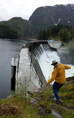
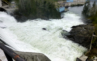
Why Ocean Falls?  It’s the water…the best tasting and softest water in the world.  It’s so good we can’t figure why some hasn’t converted the towns existing manufacturing capabilities into the world’s best beer brewery. Oh yea, the transportation costs might be a bit high. Just before docking we dropped the crab traps near the outflow of Martin Creek.  We toured the town, dam and lake.  A new bed and breakfast and pub will be opening later this summer.


The water is flowing big-time from Link Lake over the damn at Ocean Falls. Look-out below.


A big log can't quite fit through the spillway.


Captian Mike thinks he can do most anything, including freeing the log above. Here he shows off his balancing finesse prior to log "un-jamming".


Careful Captain Mike.  It's a long way down, then a cold swim too!

"Aw shucks" says Mike.  "I forgot my harness."

Monday, May 7, 2012

#10 Pretty Eucott Bay


The Wild Blue had stopped by Eucott Bay on the return Alaska cruise last August, and it reminded us a bit of Yosemite.  After our ranting and raving, the Seeker crew was eager to visit the Bay. It’s a short 3-hour tour from Bella Coola to Eucott.  The Bay is shallow so best to arrive on a plus tide, which we did at about 11AM.  As we crept into the Bay Seeker noticed an 8-foot shallow spot, meaning there was less than 3 feet under the keel.  Nice to have a rising tide!  Also, it would have been nice to realize at that point the tide was +5 feet, having been ½ foot 3 hours earlier.

Seeker pushes water so photographer Susie can get her shot.

Seeker and Wild Blue at anchor in pretty Eucott Bay.

Eucott has a natural hot springs which has been improved by the locals.  Of course we had the Bay and hot springs to ourselves, but were more excited by a large bear feeding along the shore.  Our first dinghy ride ashore spooked the shy bear inland.  Meanwhile we set crab and prawn traps, explored the creeks and hot springs.  After lunch Pat said I wouldn’t be able to get near enough to the ursus beast to capture a decent photo.  I took up the challenge. 

The bear was feeding again.  Not long out of hibernation, the bears dine on roots and grasses along the shore, while they wait for the salmon and berries.  I slowly motored the dinghy at low rpm, toward the bear from downwind, inching my way closer.  A few geese startled and flew off but the bear found a sweet root and stayed on.  I was close enough…. the new Lumix 20X zoom captured several great shots.  I guess you really don’t have to get that close anymore.

Bear poses for his photo.

Yum, I like salad!

Tonight the tide drops from a high of +17 to a low of +5 so we won't rub bottom while we sleep.  Captain Mike and Alex negotiate tomorrow's exit for Ocean Falls on the rising morning tide. Mike seems to question this happy hour navigation decision, but the evening ends with an11AM exit at +5 rising tide. 

Sunday, May 6, 2012

#9 Off the Inside Passage to Bella Coola Again

On Sunday, with the Canadian forecasters again worked up over the weather, we decided to avoid the high coastal winds and waves by moving inland. The Seeker crew wanted to visit Bella Coola and so we set sail, aka fired up the engines, and turned eastward, up Burke Channel and North Bentinck Arm to Bella Coola, some 50 miles off the Inside Passage route.  This town of about 1500 souls has a small marina with transient moorage.  Mostly commercial and sports fishing boats fill the docks and we had a difficult time finding a place to tie up.  The best we could do was “double-park”, also known as side-tying amongst boaters.  Seeker tied to the dock, and then Wild Blue tied to Seeker, with many fenders being sandwiched between the boats and docks.

Bella Coola marina.is set under the snow-covered peaks. Of course most all of BC is under snow-covered peaks this spring!

Double-parked without getting a ticket.

The town is about 3 klicks (kilometers) east of the marina so Pat was forward with a dock tenant as he approached his vehicle, and we were offered a ride.  We visited the town, consumed a couple Sleemans Honey Browns and checked out the local hardware store, which of course was closed on Sunday.  The town was pretty deserted and looked a bit down, but the few people around seemed happy.

Sunday evening the wind blew up into the 20-knot range.  With a few additional lines run to a large steel work boat, the heavy Selenes rocked and rolled, but couldn’t break free of the dock or each other.

Saturday, May 5, 2012

#8 Namu

Of all the years we've cruised BC we've never stopped at Namu proper, but instead opted to anchor behind it in Rock Inlet, a very secure weather fortress. Today the Seeker crew is introducing us to Pete and the gals at Namu, the once busy fish cannery town. Namu is located on the mainland shoreline of the Inside Passage to Alaska.  Of course this cannery town was the namesake of the killer whale Namu, who was captured nearby in 1965 and was the second orca ever displayed in captivity.  Namu became a large fishing camp with an ice plant, salmon and herring packing lines, bunkhouses, wharves, hydro plant and fuel facilities and was one of largest salmon canneries on the BC Coast in the 1950’s. As many as 1000 employees lived in Namu.  The arrival of ice plants and brine tanks on fishing boats changed the industry, where previously the boats had to be within an hour's run of the cannery to prevent the catch from spoiling.  This led to the canning outposts' decline. The "large" canning plants were demolished in the 1980s but much of Namu still remains.  Pete and the gals are the present caretakers and live on the property year round, except during the stormy winter months when they move to Rock Inlet, just behind Namu. Pete says they catch salmon right off the floats in mid-summer.  So looks like the Wild Blue will be paying another visit on the Alaska return cruise.

Namu's old restaurant and dinner house

Namu had the largest operating cold storage building in BC.

Just two of the many diesel powered generators that kept the town lighted and heated, and the salmon cold.

Their's lots of scrap metal around, including this coastal freighter which amazingly is still afloat!


#7 Across the Strait, Through the Sound, Around the Cape

Lagoon Cove is so hospitable. Usually the cruisers meet at Lagoon's boat house on the pier for fresh BC prawns, snacks, beverages and sometimes dinner. Since the Lagoon folks were just arriving, we enjoyed dining with the Seeker crew.  

Thursday's dinner topic was the coming rugged weather, keeping us pinned down on the protected inside waters.  It looked as though we might be confined to points below Cape Caution for several days as the weather passed.  Seeker and Wild Blue would be cruising together for several days so Friday's plan was to push northwest towards Cape Caution, bailing out to a secure cove when the ride became too uncomfortable.

Lagoon Cove's Boat House.

With high winds forecast for Friday, we left Lagoon Cove at after 8AM, sort of late for making any distance as we expected to be detouring to Sullivan Bay, Blunden Harbor, or Allison Cove, protected weather anchorages for crossing the Queen Charlotte Strait and Sound before rounding Cape Caution. We motored out onto the Strait and the wind was 10 knots or less, so we continued passing Sullivan Bay.  Then we made Blunden Harbour with light winds and moderate seas and decided to continue.  At Allison Cove with a West Sea Otter Buoy forecast of less than a meter seas, we decided tp round Cape Caution while the "getting was good".  We ended the day at 8:30PM anchored in little Frypan secure in light winds.

Our 12-hour run from Lagoon Cove to Frypan Anchorage.


Seeker rounds last point at Rivers Inlet, turning towards Frypan Anchorage.